 login
loginSt. George Trip
-
 No new posts


| Moderators: k9car363, alicefoeller | Reply |
 2009-06-12 1:01 PM 2009-06-12 1:01 PM |

Veteran  192 192   Southern California Southern California |  Subject: St. George Trip Subject: St. George TripWe are heading out there this weekend to preview the IM course and see the sights. Probably do 1 loop of the bike and perhaps one of the run. Also going to try to get out to the lake and see it as well. We are staying in the same hotel as we will be next year. Any suggestions or tips related to the race and checking things out? Things to look out for? Anyone want me to try and have a look at something particular? Anyone have any tips while in the area for other things to do? We are planning to hit Zion, but we have only a couple of days and would like to get the kids out and about a bit. |
| 2009-06-13 9:09 PM in reply to: #2213740 |
Extreme Veteran 475 Traverse City, MI | Subject: RE: St. George Trip Can't wait to hear your course report! |
| 2009-06-15 11:28 PM in reply to: #2213740 |
Veteran 192 Southern California | Subject: RE: St. George Trip Did the loop today and it is no joke, full report when I get back home with pictures. Took a peak at the lake and will try and get out to the run tomorrow. |
| 2009-06-18 3:27 PM in reply to: #2213740 |
Veteran 192 Southern California | Subject: RE: St. George Trip Uploaded some photos today, here are a few: More in the album: http://www.beginnertriathlete.com/discussion/photos/photo-thumbnails.asp?albumid=12454 I did not get a chance to run the Run Course, but we covered some while on the bike and I drove most of the rest on the way out of town. Only had 2 ful days there and most of the time was spent up near Zion with the family. I will add more after I get things back in order around the house and work. |
| 2009-06-18 3:58 PM in reply to: #2213740 |
Champion 5781  Northridge, California Northridge, California | Subject: RE: St. George Trip Great pictures...thanks for sharing! |
| 2009-06-18 7:58 PM in reply to: #2213740 |
Expert 1258 Marin County, California Marin County, California | Subject: RE: St. George Trip X2 Thanks for sharing the photos! It's nice to get a look at the area! |
| 2009-06-20 12:18 AM in reply to: #2220277 |
| 5 | Subject: RE: St. George Trip You are scaring me with the "no joke" part! St. George will be my first IM. Can't wait for details on the bike course. Am already starting hill training here in TX. Hope to get out this fall to check out the course...thanks for your input. We all appreciate it! |
| 2009-06-25 10:46 AM in reply to: #2213740 |
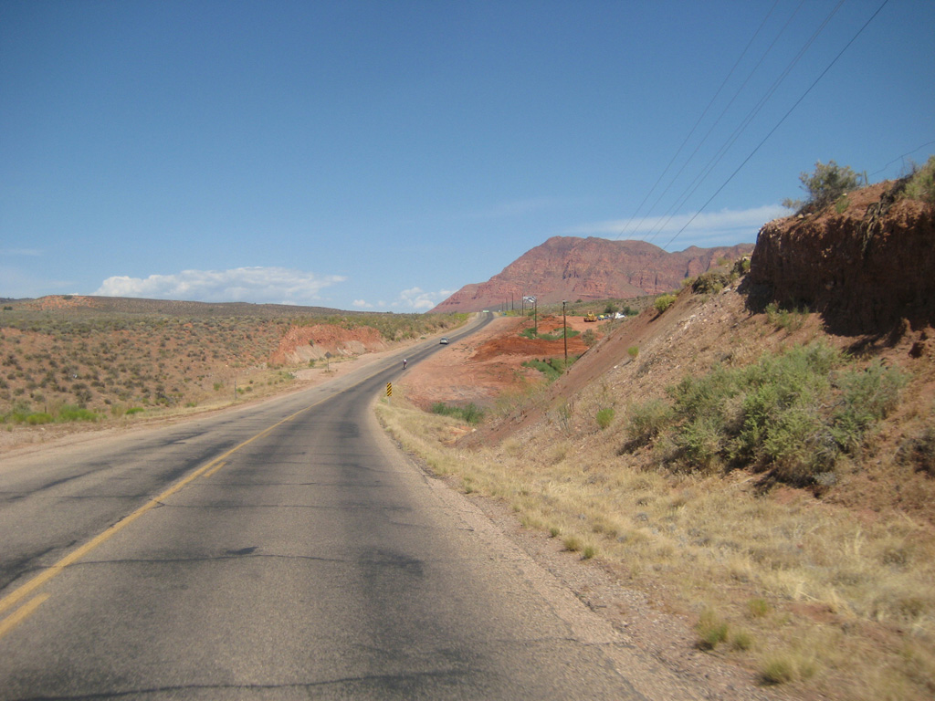
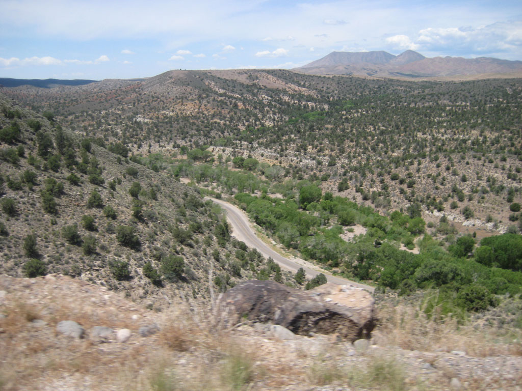
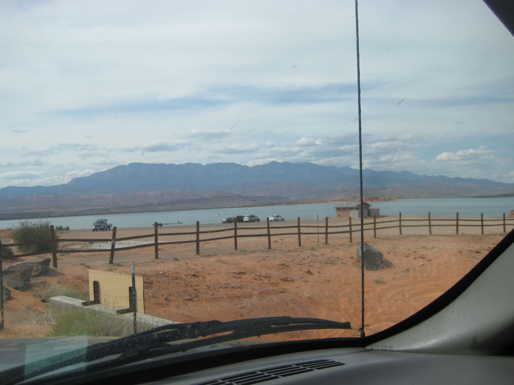
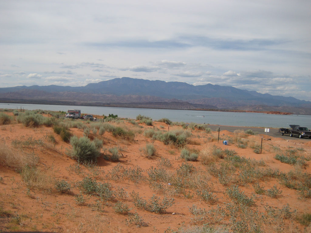
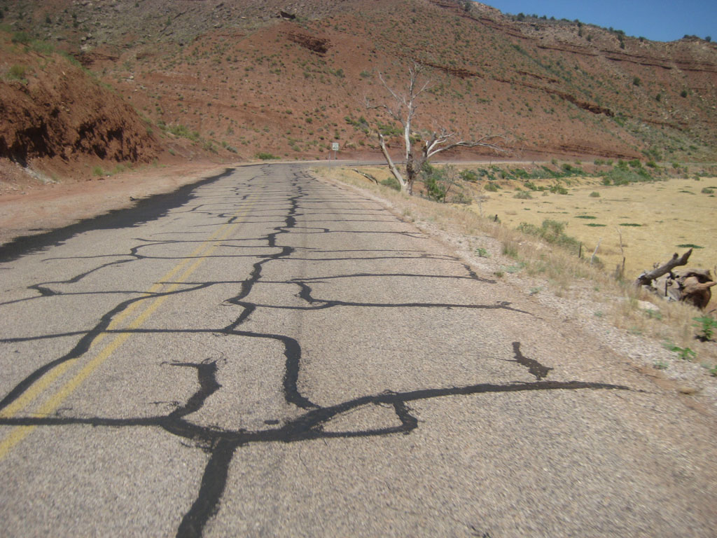
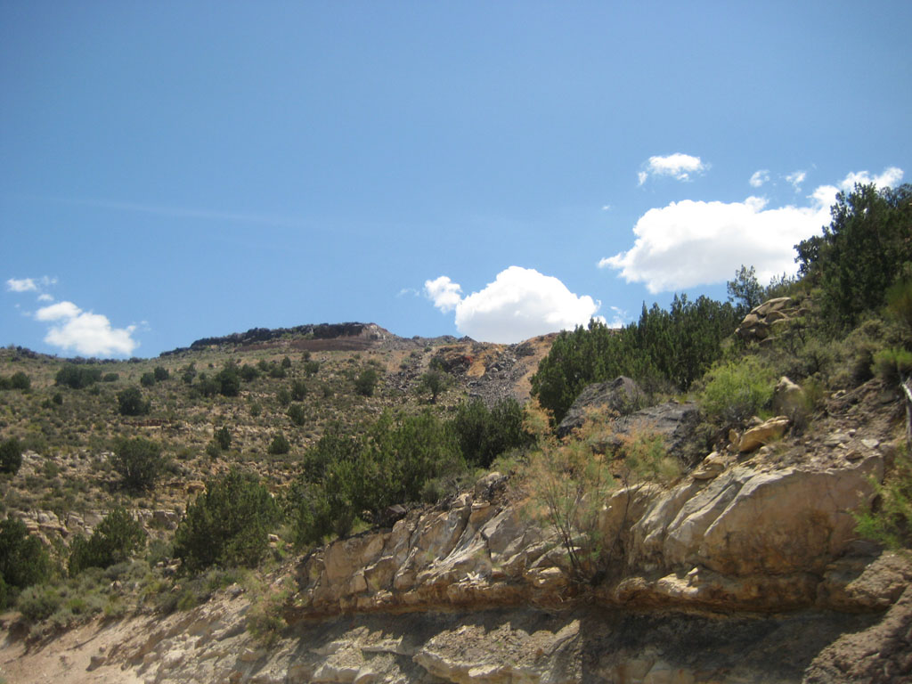
Veteran 192 Southern California | Subject: RE: St. George Trip Official Course Maps: http://www.ironmanstgeorge.com/course.php The pictures are the same as in the above post, but used here for context. Swim: We went up to the lake and had a look from the road. It is a pay-use area and I didn’t want to pay, but you could see from the road on the outside of the fence that parallels the road on the inside. I think that the swim start is across the lake from where I was. Here are the photos I took of the area:
Bike: This should be a challenging ride, how it compares to other IM courses I cannot say since this is going to be my first IM. We rode one loop of the course and back down to T2 from our motel that was about a block from the finish so we missed riding the section between T1 and the loop start, but we drove it.
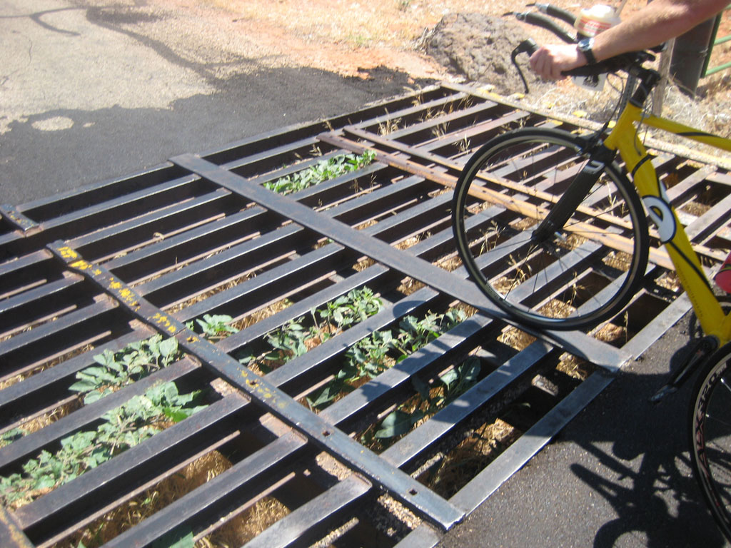
You now turn off to CR-3184/Gunlock Rd. and the pavement get worse here. The next landmark will be Gunlock Reservoir. This is about 5.5 miles out on CR-3184/Gunlock Rd. There is one steep section leading up to the reservoir maxing out at about 8% with the rest being fairly constant with maybe one other bump up and a cattle guard.
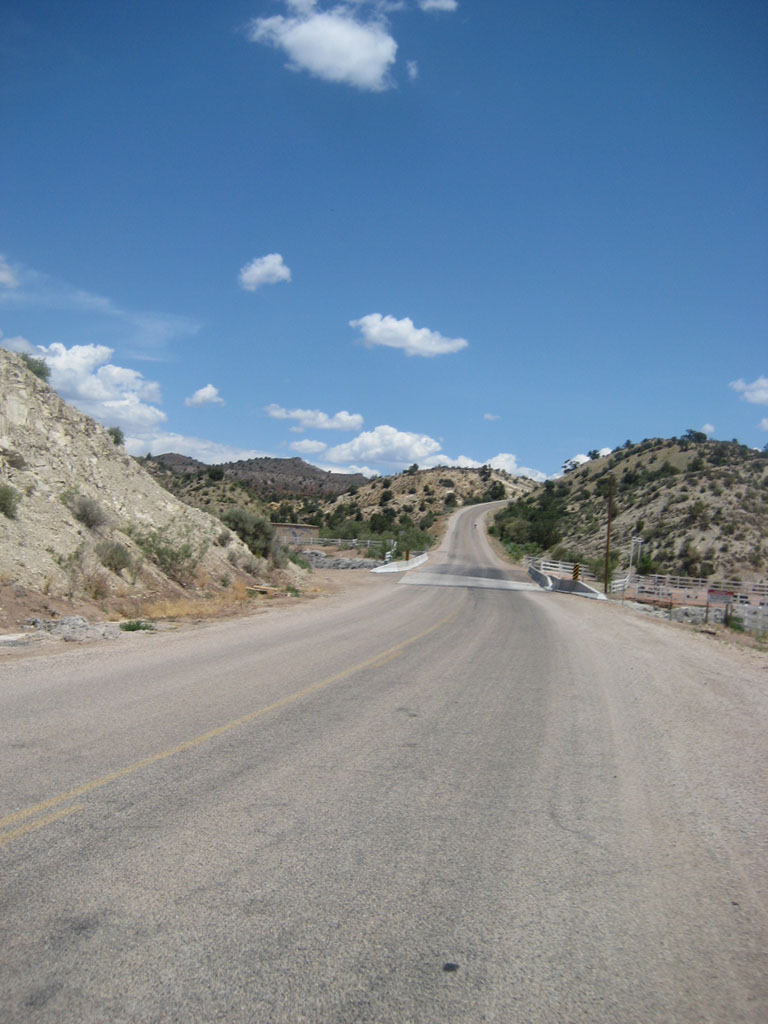
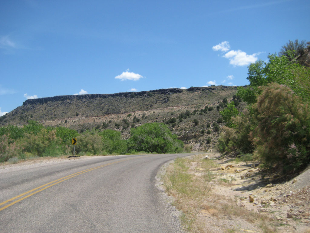
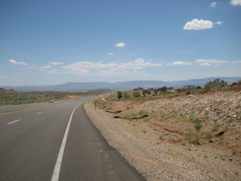
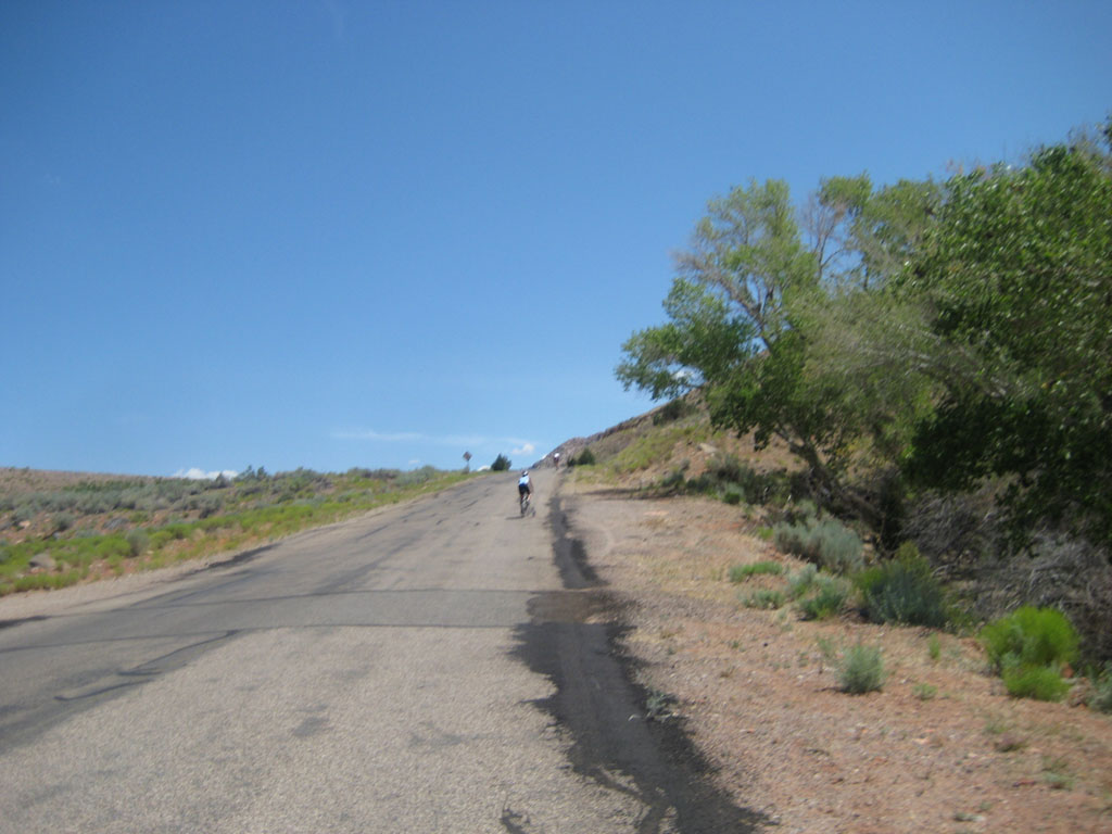
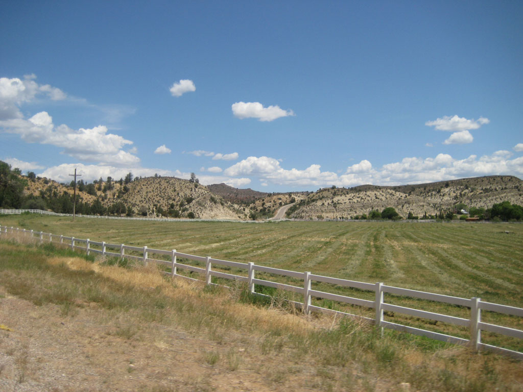
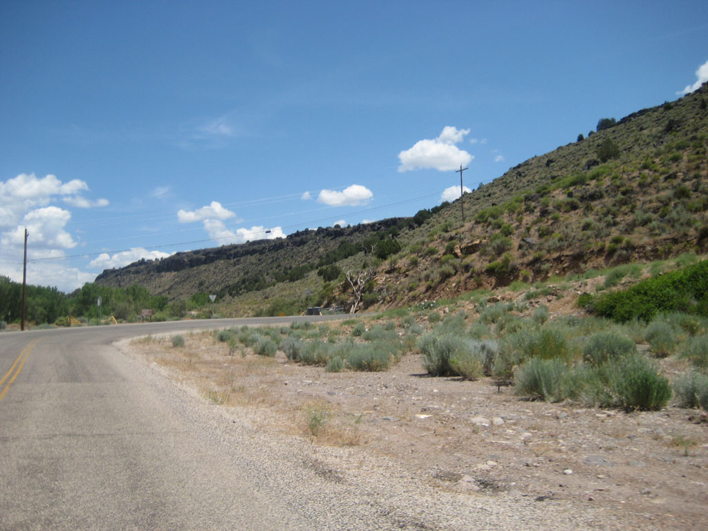
Once past the reservoir there is a lovely gravel pit and then another cattle guard before entering Gunlock. Gunlock is has just about the only shade on the loop, so enjoy it. After leaving Gunlock there is a nice field with a white fence that is right before the steepest(but short) part of the loop. You can see the road go up in the distance of the above picture. It is about 1/3 of a mile long and gets up to about 13%. Should be fun the second time around. Here are a few more pictures of it. About 2.5 miles after this hill is the switch-back that climbs up to the top of the plateau. You can see it as you approach in the side of the plateau and know you are about to have some fun. It is about a mile long and gets to about 12-13% near the top. This too will be enjoyable the second time around. These show the lead up to and the climb on the switch-back. This really was not that bad, you just need to save something for it. After this Highway 18 is about 2 miles and is still a steady up. Nothing over 5% and about 150ft of ascent. Once on the 18 there is some more of the going up stuff. Five more miles and 300ft and you are at the top. The first mile and a half is the toughest part and has most of the ascent in it along with maxing out at 7%.
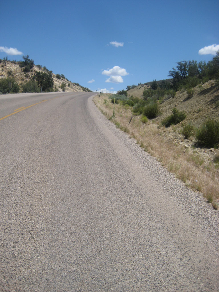
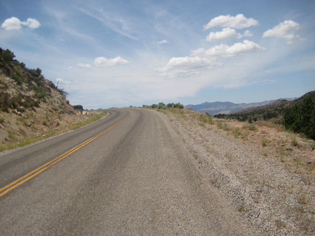
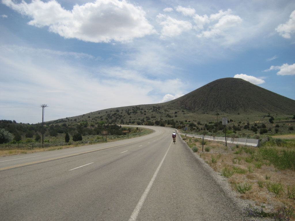
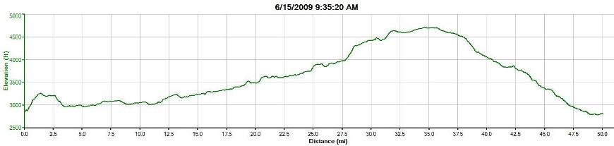
Now the downhill, time to relax. It is about 12 miles to the loop start and most of can be done without much pedaling. I got over 40mph on at least 3 sections without trying and was easily in the mid to high 20s for the rest except for a couple of small bumps up. The pavement was decent, but I was on my road bike with clip-ons so I used my drops on the faster sections instead of being areo. I didn’t get very many pictures of this part, here is one. After the second loop, you will have about 2.5 miles to T2. This too is mostly downhill and should be straight forward. A couple of round-abouts to navigate and then into the transition. T2 is at about 2500 elevation and the top of the bike course is about 4700 elevation and that is just before the descent on Highway 18. The course profiles on the Official website are a bit misleading because they compressed them horizontally. Here is mine for the loop and back down to T2(The first mile of uphill is not part of the course). The run course goes back up to the bike course to the loop turn around and head back down the bike course that was before the loop start. The hills will be fun, especially if you went too hard on the bike. Not much else to say about it since I only drove it. Edited by bwiens 2009-06-25 10:56 AM |
| 2009-06-25 2:13 PM in reply to: #2230380 |
| 1 | Subject: RE: St. George Trip Thanks for the thorough report. It looks beautiful. I also know know I need to find some pretty steep hills to work. Hey Trimom1 I'm also in Texas and IMSG is going to be my first IM too. Do you have hills nearby you to work or are you like me and have to travel at least an hour for significant hills? Edited by freeflying_soul 2009-06-25 2:22 PM |
| 2009-06-25 2:40 PM in reply to: #2213740 |
Champion 8766 Evergreen, Colorado Evergreen, Colorado | Subject: RE: St. George Trip Wow...that's going to make the last 15 miles feel pretty darn nice. All downhill at that point! I would take that over it climbing the last 15 miles for sure! But if it's a cold day y'all will freeze on that descent...might need to think about bringing a jacket! |
| 2009-06-25 9:38 PM in reply to: #2213740 |
Extreme Veteran 475 Traverse City, MI | Subject: RE: St. George Trip Thanks for the awesome course report! I'm weak on the hills so I have some work to do. Fortunately I have some good rollers nearby to train on - this summer. |
| 2009-06-25 11:39 PM in reply to: #2213740 |
Extreme Veteran 438 Surprise, AZ | Subject: RE: St. George Trip I am planning a trip in October, was there any gas stations or ways to get water on the loop? Do you know about how much elevation gain you had per loop? |
| 2009-06-26 12:07 AM in reply to: #2213740 |
Pro 4909 Hailey, ID | Subject: RE: St. George Trip A good preview on ST. http://forum.slowtwitch.com/gforum.cgi?post=2326404;sb=post_latest_... And video of bike course by computrainer group: http://www.youtube.com/watch?v=6nEGNuSQLpo |
| 2009-06-26 10:19 AM in reply to: #2213740 |
Veteran 192 Southern California | Subject: RE: St. George Trip We stopped at the intersection CR3184 and Highway 18. There is a store there that has bathrooms and just about anything else you want. My Garmin showed about 2900 for the loop, I think that is a bit high though. Probably around 2500 per loop and some more leading up to it. |
| 2009-06-30 2:21 PM in reply to: #2213740 |
Regular 126 East San Francisco Bay Area | Subject: RE: St. George Trip Wow, thats great info. Thanks for the pictures and the report. IMSG gonna be my first as well. I am gonna start working the hills in my area... plenty of em in the San Fran area. |
| 2009-07-03 4:43 PM in reply to: #2213740 |
Extreme Veteran 475 Traverse City, MI | Subject: RE: St. George Trip Does anyone know if they will cover the cattle guard or leave it and park an ambulance there? |
| 2009-07-09 11:38 AM in reply to: #2260612 |
| 8 | Subject: RE: St. George Trip I was telling my buddy about these, who did New Orleans, where the course also had cattle guards... and he mentioned that those were covered. I guess they are an issue since they are on the ascent. If they were on the downhill, we could just bunny hop them.  |
| 2009-07-13 2:02 PM in reply to: #2213740 |
Master 1359 South of SLC | Subject: RE: St. George Trip Great recon Ben. I have run the St. George Marathon a couple of times and there are hills that are tough but manageable. The St. George Olympic Tri that starts at Sand Hollow also runs up some of the same hills that are not part of the loop but just the route to get to the loops. Ben, just curious, what cassette were you running? I read some of the posts on ST about the route (JackBauer's was one of the best) and they also gave a decent idea about the course. But for us mortals, we want to know which cassette you were running... Mike |
| 2009-07-13 5:01 PM in reply to: #2213740 |
| 8 | Subject: RE: St. George Trip Great pix. My wife and I drove the bike and run course on 6/26. We did notice that they were re-paving the area past Gunlock. Some of us are planning a road trip in March / April. Living in So Cal it's only a 5-6 hour drive. |
|
|
|
 View profile
 Add to friends
 Go to training log
 Go to race log
 Send a message
 View album